
A more efficient view on water
The ports in our country serve as vital economic hubs and demonstrate a commitment to ecological awareness. The development of a port reflects our relationship with the environment and our methods of separating water from land to ensure the controlled management of port activities. This segregation is achieved through various means, including the implementation of seawall techniques (also referenced in our case study on HARO blocks). While these techniques are relatively straightforward to chart due to their fixed structure and location, mapping out the movements of water bodies crashing against these structures poses a greater challenge. This challenge has been a focal point for the Department of Mobility and Public Works (MOW) of the Flemish Government for some time. This is where Vectr.Consulting steps in to provide assistance.

Automatic labeling
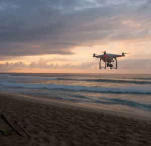
The General Technical Support Department (ATO) assists the Department of Mobility and Public Works in mapping images around bodies of water. Using drones, the ATO cell captures a multitude of aerial photographs of port infrastructure through photogrammetry. Optical cameras create 3D models, within which delineated objects such as locks or breakwaters are relatively easy to distinguish. However, 3D rendering software struggles with bodies of water. Currently, many of these bodies of water are manually masked. To streamline this time-consuming process, we are collaborating with MOW to develop a machine-learning model that is automatically applied to all new drone photos.
Based on the manual labeling already conducted, we train our own model, called the Segmantic Segmentation Model. Simply put, in a drone photo of a body of water, each pixel where water is detected is marked as a 0, and where it is not detected, as a 1. Metrics calculations, such as Intersection over Union (IoU), are used in ML processes to measure accuracy and error margins of this 0/1 localization. The results are displayed in a score. MOW’s trained model achieves a score of 0.985 in test jobs, meaning only a very small number of pixels are incorrectly labeled.
 The client can upload all images it captures to an Azure Storage Container, where they enter a data pipeline to be analyzed by the model. Subsequently, the output images are placed in a second Storage Container where the client can download them. Client feedback allows us to adjust and optimize the model accordingly. The model is written in Python with Pytorch as the Deep Learning framework. Azure Machine Learning, a well-known cloud service from Microsoft, is used to manage our training and test jobs. Additionally, the model is tracked in the AzureML Model registry to manage all trained models. Finally, all infrastructure is managed using Terraform, an infrastructure-as-code tool.
The Mobility and Public Works Department (MOW) of the Flemish government makes Flanders move: by road, by water and by air. Their experts on the move work every day for safe, smart and sustainable mobility and for today’s road and (air)port infrastructure. The MOW Department supports the Minister’s policy in terms of content, both for mobility and traffic safety and for investment, management and operation of the transport and port infrastructure. The MOW Department also performs administrative and technical support tasks including expertise and advice on concrete and steel structures, ground tests, dynamic traffic management, hydrological research, and so on. Finally, the Department also guarantees maritime access to the Flemish seaports.
More info on vlaanderen.be
A succesful continuation
As experts in data intelligence, we are extremely proud to assist MOW in the realm of machine learning with object detection and ML ops. This collaboration was made possible through Cronos Public Services, a division of the Cronos Group that aggregates and facilitates the expertise of its subsidiary companies for government services. For quite some time now, Cronos has maintained a framework contract with the department. With the support of Cronos and MOW, Vectr.Consulting can continue its efforts to enhance the effectiveness and safety of our surroundings by deploying appropriate technology.
Every time there have been new drone flights around the port, our AI application is used to mark bodies of water. This ultimately results in serious time savings for drone pilots and more accurate labeling of the water bodies. Work is also ongoing to improve the model to perform optimally in other areas, such as rivers and canals.
In addition to detecting bodies of water, we also assist MOW with other ML projects. Be sure to check out our case studies on detecting HARO block movements and Unsafe traffic situations.